
How to Find Easy Coastal Paths (Salcombe & South Devon)
05 September 2026
Table of Contents
- What Makes a Coastal Path Easy?
- Start with the South West Coast Path Accessibility
- Use OS Maps and Online Tools to Plan Easy Coastal Paths
- Best Short Walks South West Coast Path Near Bolberry
- Easy Walks Near Salcombe for Families and Groups
- Look for Signposting and Path Conditions
- Plan Your Easy Coastal Path Day from Spring Barn
- Frequently Asked Questions
Last Updated: September 5, 2026
Finding easy coastal paths doesn't require expert navigation skills or weeks of research. The secret lies in knowing which routes to prioritise, how to read a map for gradient clues, and where to look for reliable local knowledge. This guide from Spring Barn at Bolberry Court focuses on the Salcombe and South Devon coastline, where gentle cliff-top trails and sheltered estuary walks sit alongside more demanding stretches. Easy coastal paths are routes with firm, even surfaces, modest gradients, and clear waymarking, suitable for families, older walkers, and dogs. We will show you exactly how to identify them before you set out, so every walk feels like a reward rather than a slog.
What Makes a Coastal Path Easy?
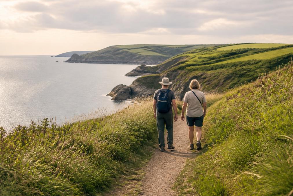
An easy coastal path is one with a steady, well-drained surface, minimal steep climbs, and reliable waymarking throughout. Think of the difference between a level, grassy cliff-top trail and a rocky descent into a steep combe; the former suits most abilities, the latter demands care. Look for routes that the local authority or National Trust maintain regularly, as these tend to have smoother surfaces and sturdier gates. Paths that follow field edges or old railway lines often qualify, as do sections of the coast that stay high above the cliffs without plunging to sea level. A good test is whether you could push a sturdy buggy along it, or walk it comfortably in trainers after rain. When researching, filter for terms like "gentle", "family-friendly", or "accessible", and check recent walk reports rather than guidebook descriptions from years ago.
Start with the South West Coast Path Accessibility
The South West Coast Path accessibility varies enormously by section, so treating the entire 630-mile trail as one entity is a mistake. The official South West Coast Path website provides detailed access statements for each stretch, including information on gates, stiles, and surface conditions. Near Salcombe, the path between Bolt Head and Bolberry Down is notably forgiving, with a wide, grassy tread that follows the cliff top at a consistent height. The National Trust, which manages much of this land, publishes its own accessibility guides for South Devon coast, flagging which routes avoid steep gradients and kissing gates. Many easy coastal paths in this area were originally farm tracks, so they hold a gentle camber and drain well even after wet weather. If a section description mentions "exposed cliff edges" or "narrow sections", treat it as moderate rather than easy, regardless of distance.
Use OS Maps and Online Tools to Plan Easy Coastal Paths
Ordnance Survey maps remain the most reliable planning tool because contour lines reveal the truth about gradient at a glance. Tightly packed contour lines signal a steep climb, while widely spaced lines indicate a gentle slope; easy coastal paths sit where those lines spread apart. The Ordnance Survey's online mapping service lets you toggle a terrain layer and measure distance precisely, which helps you estimate time realistically. Several walking apps also display user-reported photos and recent trail conditions, giving you a sense of what the surface looks like today rather than what it looked like in a stock photo. Search for "easy walks near Salcombe" and cross-reference three sources before committing; if two describe a route as flat and one mentions a scramble, trust the cautious account. Print or screenshot your chosen route, because phone signals fade quickly in the deeper valleys around the South Hams.
Best Short Walks South West Coast Path Near Bolberry
The best short walks South West Coast Path near Bolberry share one feature: they deliver dramatic sea views without demanding a full day's effort. A classic is the circular route from Bolberry Down car park out to Bolt Head and back, roughly three miles on a level, grassy track with panoramic views across to the Eddystone Lighthouse. Another favourite heads north from Bolberry Down towards Hope Cove, dropping gently into the village for refreshments before returning along the same path; the out-and-back format means you can turn whenever energy levels dictate. For an even shorter option, walk from the hamlet of Bolberry itself down to the coast at Bolt Tail, a mile each way on a clear, well-trodden path. These routes work well for multi-generational groups because nobody feels pressured to keep pace, and the rewards arrive within the first ten minutes of walking.

Easy Walks Near Salcombe for Families and Groups
Easy walks near Salcombe for families and groups often follow the estuary rather than the open coast, where the terrain is naturally flatter and more sheltered. The Salcombe to North Sands stretch runs along a level, surfaced path with benches and beach access, perfect for younger children who need frequent stops. For a longer outing, park at the National Trust car park at Bolberry Down and walk the cliff path towards Bolt Head; the route stays high with no significant ascents, and the open grassland gives children room to roam safely away from the edge. Groups with older members should aim for walks under four miles with a pub or café at the midpoint, which breaks the day into manageable sections. The enclosed garden at Spring Barn at Bolberry Court provides a secure space for children and dogs to burn off energy before and after these outings, making it a practical base for planning your coastal adventures.
Look for Signposting and Path Conditions
Good signposting is the single most reliable indicator of an easy coastal path, because well-maintained routes always carry clear waymarkers. Look for the National Trust acorn symbol and the South West Coast Path's distinctive signposts at every junction; their absence suggests a route that may be overgrown or confusing. Check the path surface before committing: easy paths have compacted earth, grass, or gravel, while difficult ones reveal exposed tree roots, loose stones, or muddy sections that persist after rain. Stiles are another clue, as accessible routes replace them with gates or gap stiles that dogs and buggies can manage. When you encounter a steep descent to a beach, remember that you must climb back out, so assess the return journey before heading down. If the path narrows to less than a metre or runs close to an unfenced edge, consider turning back rather than pushing on.
Plan Your Easy Coastal Path Day from Spring Barn
Planning your easy coastal path day from Spring Barn at Bolberry Court starts with checking the tide tables, because several of the best routes along this stretch become impassable at high water. Aim to set off by mid-morning, when the coastal mist has usually burned off and the light is at its best for photography. Pack layers even in summer, as the breeze along the exposed cliff tops can drop the temperature noticeably, and carry more water than you think you need. The South Hams has a network of excellent cafés and pubs within a short drive of the coast, so build a refreshment stop into your route rather than carrying a full picnic. Spring Barn's position in the hamlet of Bolberry puts you within minutes of the paths described above, and its EV charging point means you can arrive with a full battery and leave it topped up while you walk. For larger groups, the property sleeps up to ten people, giving everyone space to rest and recharge between days on the trail.
Planning Step | What to Check | Why It Matters |
|---|---|---|
Route selection | Gradient, distance, surface type | Matches ability levels across your group |
Tide times | High water windows | Some coastal sections become impassable |
Signposting | Waymarkers and gates | Confirms the path is maintained and clear |
Weather forecast | Wind speed, visibility | Exposed cliff tops cool quickly |
Refreshment stops | Cafés and pubs on route | Breaks the walk into manageable sections |
The South Devon coast rewards those who plan, and easy coastal paths are plentiful once you know what to look for. Start with the gentle cliff-top routes around Bolberry Down, use OS maps to confirm gradients, and always trust signposting over guesswork. A holiday base that puts you minutes from these trails makes the difference between a rushed day out and a relaxed one. Spring Barn at Bolberry Court offers that proximity, with spacious accommodation for groups up to ten and the practical touches that make coastal walking holidays effortless. Check availability and plan your walking break today.
Frequently Asked Questions
Are there easy sections of the South West Coast Path near Salcombe?
Yes. The stretch from Bolberry Down towards Hope Cove is one of the more forgiving sections, with grassy paths and relatively gentle gradients compared to other parts of the coast path. The National Trust maintains the Bolberry Down area well, offering clear routes that stay level along the cliff tops. For the easiest experience, start at the National Trust car park and follow the signs toward Bolt Head, keeping to the main path rather than the steeper descent routes to the beaches below.
How do I find flat coastal walks in South Devon?
Look for routes along cliff tops rather than paths that drop down to coves and beaches. The South West Coast Path accessibility varies greatly, so check the terrain profiles on the official South West Coast Path website before setting out. In the Bolberry and Salcombe area, the path between Bolberry Down and Prawle Point follows high ground with fewer steep climbs. You can also filter routes on the Ordnance Survey app by difficulty rating, which flags sections with steep ascents or rough ground.
Is Bolberry Down suitable for easy coastal walking?
Bolberry Down is an excellent choice for easy coastal walking. The National Trust manages the headland with well-maintained grass paths and several circular route options that stay level along the cliff tops. You can park at the National Trust car park and walk out to the viewpoint without tackling any significant hills. The paths are firm underfoot in dry weather, though they can become muddy after rain. From Bolberry Down, you can see along the coast toward Salcombe and Hope Cove, making it a rewarding and accessible walk.
How long does it take to walk from Bolberry to Salcombe?
The walk from Bolberry Down to Salcombe along the South West Coast Path covers roughly 5 miles and takes most walkers between two and three hours each way. The route passes through scenic headlands including Bolt Head and Sharpitor, with several steep sections where the path descends and climbs around small valleys. For an easier option, consider walking the gentler section from Bolberry to Hope Cove (about 1.5 miles each way) and save the longer Salcombe stretch for a day when you have plenty of time and energy.